®
SHIPSPOTTING.COM
WELCOME TO SHIPSPOTTING.COM
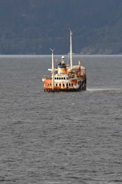
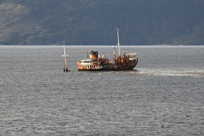
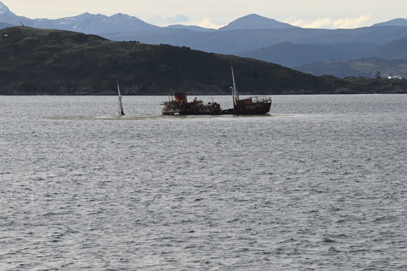
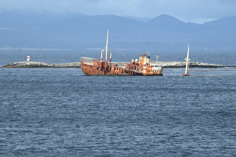
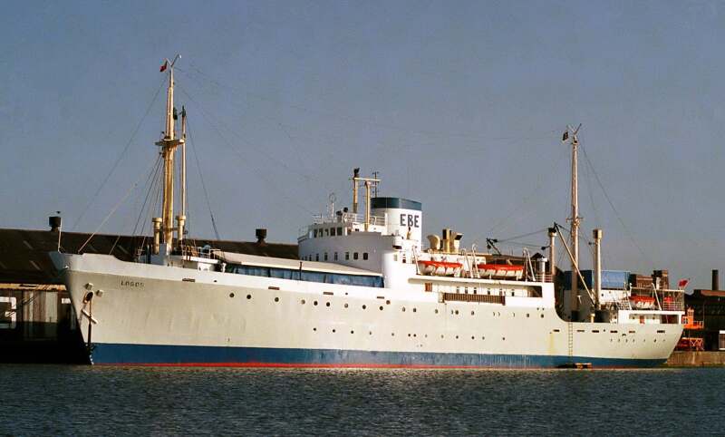
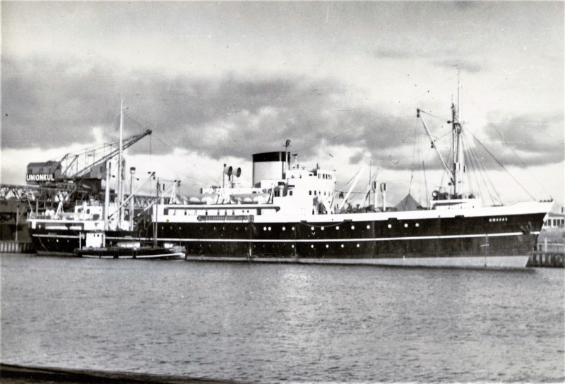
Logos - IMO 5372745

Photo
details
Photographer:Tina [ View profile ]
Captured:Feb 10, 2013
Title:Logos
Photo Category:Wrecks & Relics
Added:Oct 17, 2015
Views:1,935
Image Resolution:3,654 x 2,744
Description:
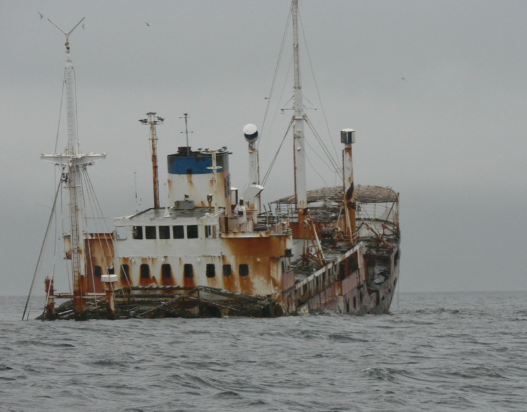
Missionary ship owned by Operation Mobilisation, that ran aground on rocks in the Beagle Channel in atrocious weather conditions at January 6th 1988. Although the ship could not be saved, not a single crewmember was lost or even injured.
AIS Position
of this ship
There is no AIS Position Data available for this ship!
Would you like to add AIS Coverage?
 Add AIS Coverage
Photo
Categories
This ship exists in the following categories:
Casualties - 4 photos
Passenger Vessels - 1 photos
Wrecks & Relics - 8 photos
Special Purpose Vessels - 5 photos
General cargo ships built 1940-1949 (Under 3000gt) - 1 photos
Photographers
of this ship
(13)
1 photos
1 photos
1 photos
1 photos
1 photos
1 photos
1 photos
3 photos
2 photos
1 photos
1 photos
1 photos
4 photos


COMMENT THIS PHOTO(1)
She provided cargo, mail and passenger services between Denmark and Greenland until 1969.
In September 1970 she was acquired by Educational Books Exhibits Limited of U. K. and renamed MV LOGOS to be used as a missionary ship and floating library.
On a voyage from Ushuaia to Puerto Madryn she grounded 500 yards off Solitario Islet at 54° 57' 42" S and 067° 07' 42" W on January 4, 1988 due to a navigational error.
Although the ship could not be saved, no crew members were lost or injured. The skeletal structure of the ship is still visible and has become something of a tourist attraction over the years.
Location: 54°58'12.5"S 67°07'51.6"W
Google maps:
https://acortar.link/WpsB75
Edit
comment